


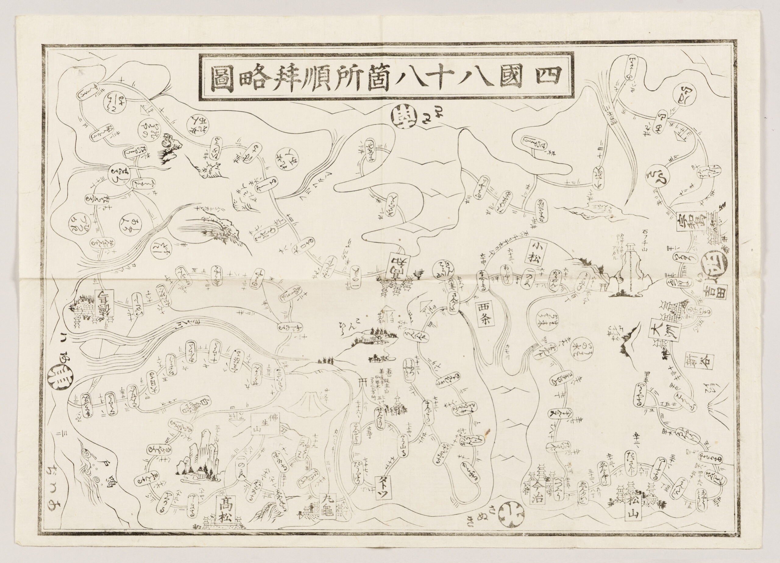
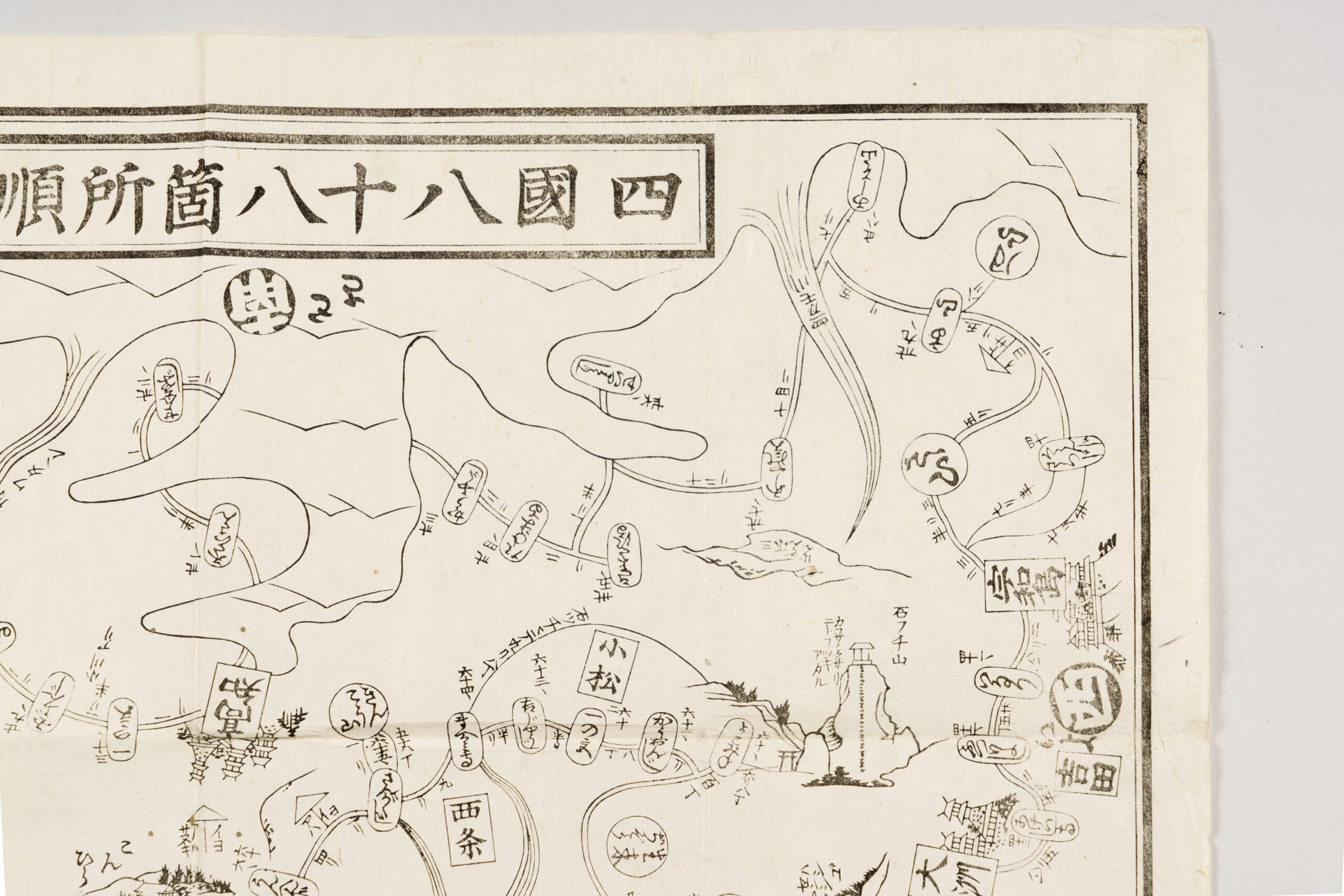
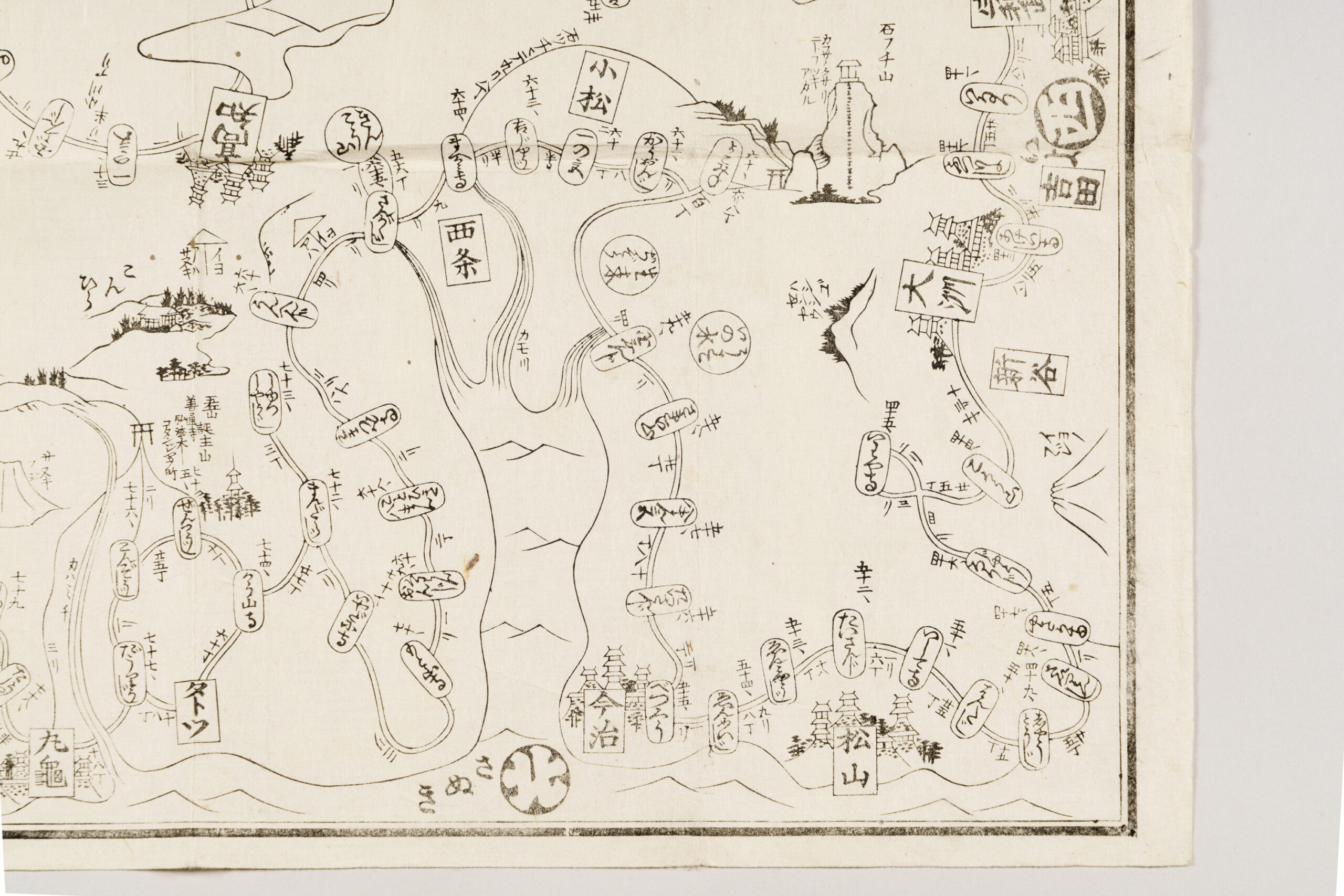
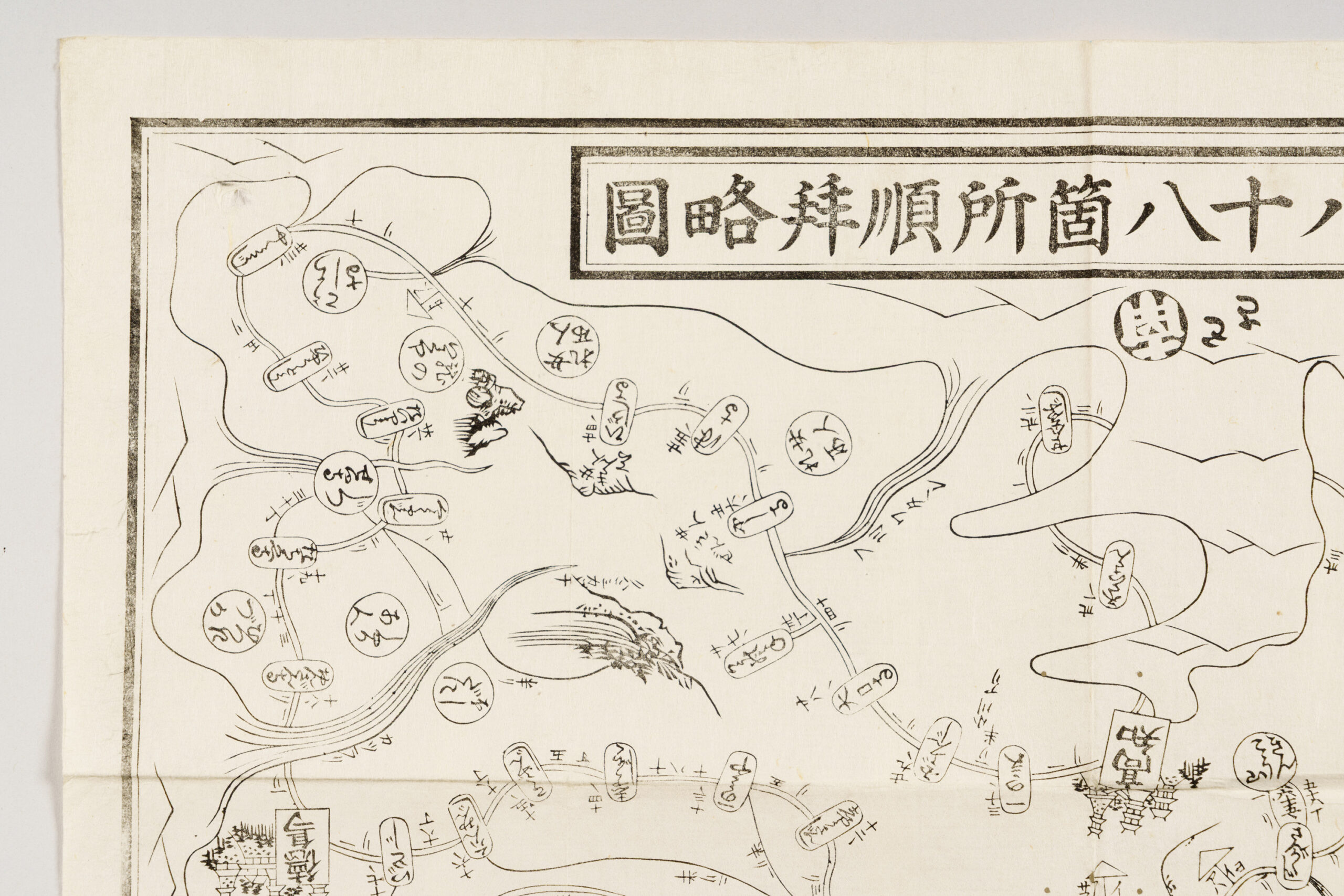
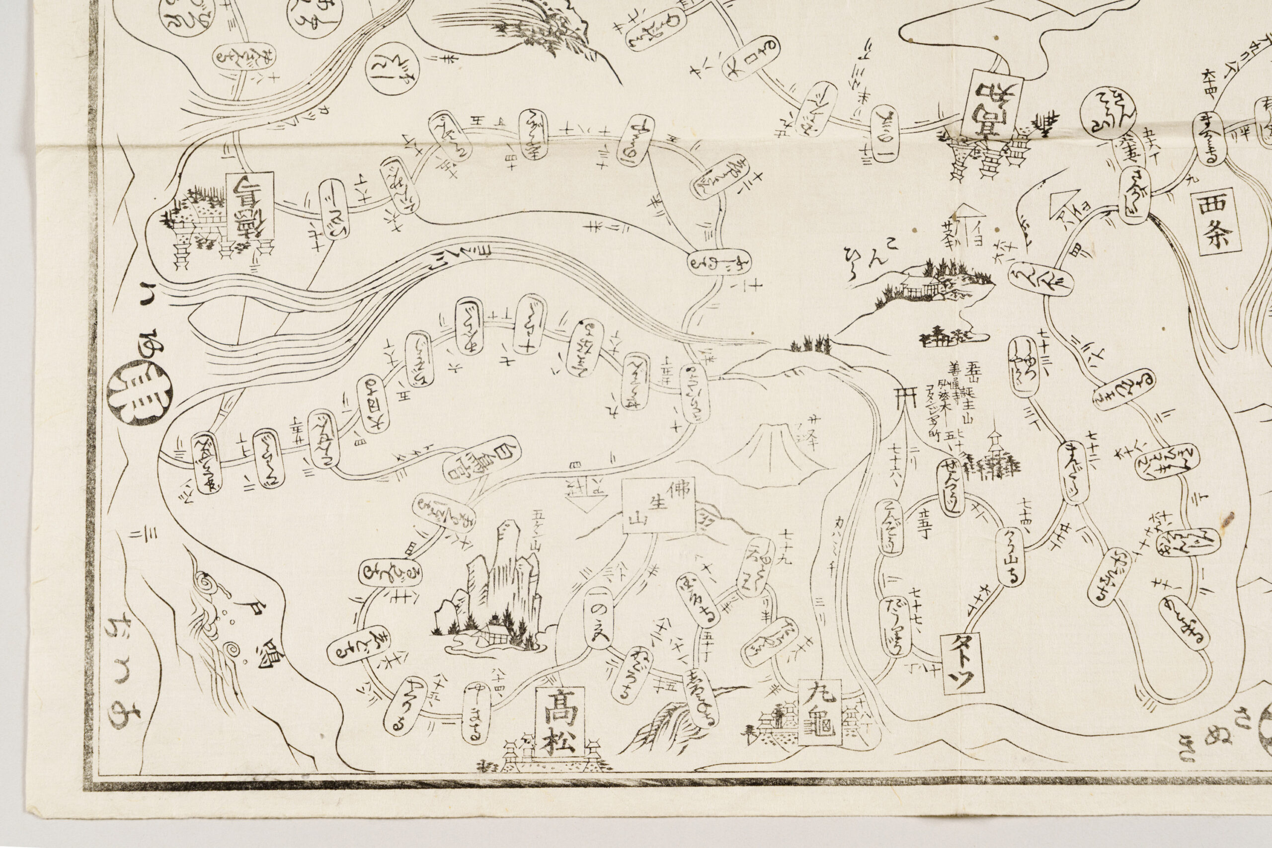
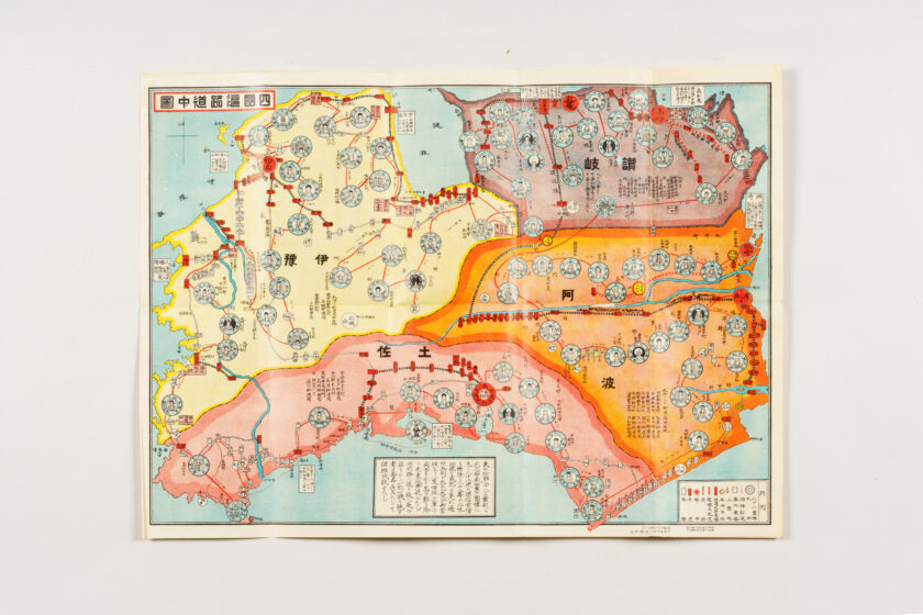
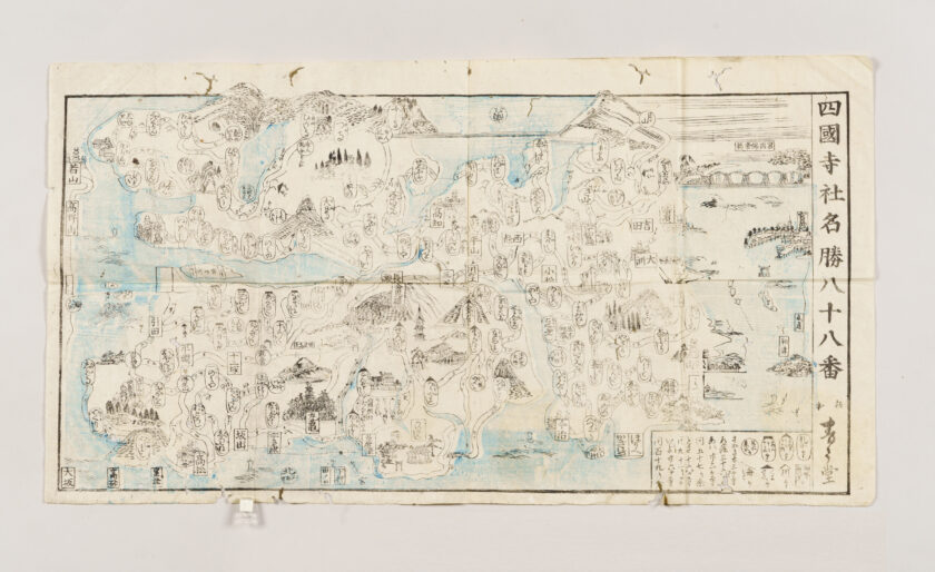
Shikoku Pilgrimage Map
- Artist
-
-
- Period
-
Edo period, late 18th–early 19th century
- Quality and quantity
-
Multi-color woodblock print, one paper
- Size (cm)
-
H 34.7 × W 48.4
- Category
-
Other
- Accession number
-
B96000450
Description
This guide map to the Shikoku pilgrimage presents the island of Shikoku with Tosa, which is in the south, at the top. It records the roads and distances between the sacred sites (fudasho), along with castle towns and other key locations along the pilgrimage route. The map also includes illustrated views of notable sites beyond the eighty-eight temples, such as Konpira (the present-day Kotohira-gū), Sanuki Fuji (Mt. Iinoyama) and Busshōzan, as well as Takamatsu Castle and other castles. The Tō-ji and Sai-ji temples (the present-day Hotsumisaki-ji and Kongōchō-ji, respectively) in Tosa Province are marked nyonin kinsei, indicating that women were not permitted to worship there at the time. Nearby, women’s pilgrimage sites (nyonin fudasho) are shown, offering valuable insight into the customs of the pilgrimage in the Edo period.