


Shikoku Pilgrimage Guide Map
- Artist
-
Mineemon (dates unknown)
- Period
-
Edo period, late 18th–early 19th century
- Quality and quantity
-
Two-color woodblock print, one paper
- Size (cm)
-
H 35.0 × W 65.2
- Category
-
Other
- Accession number
-
B95000188
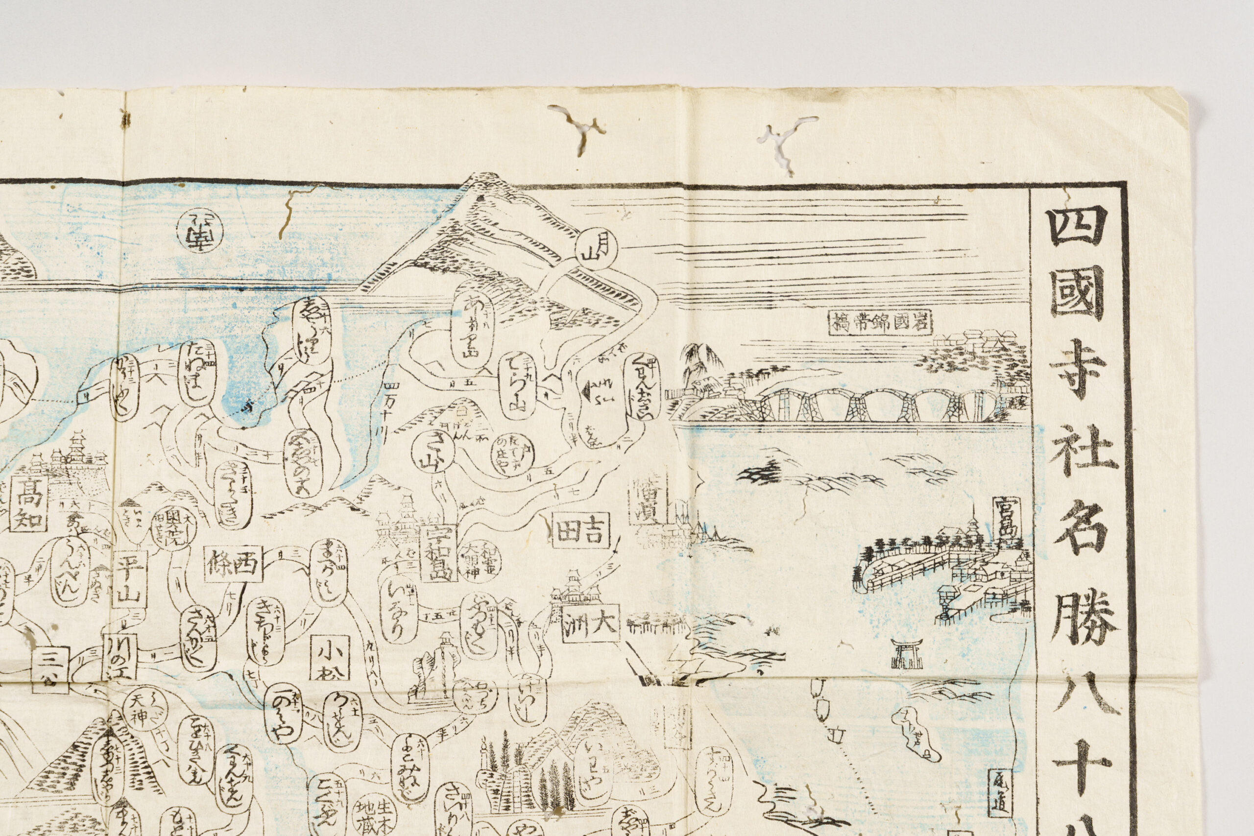
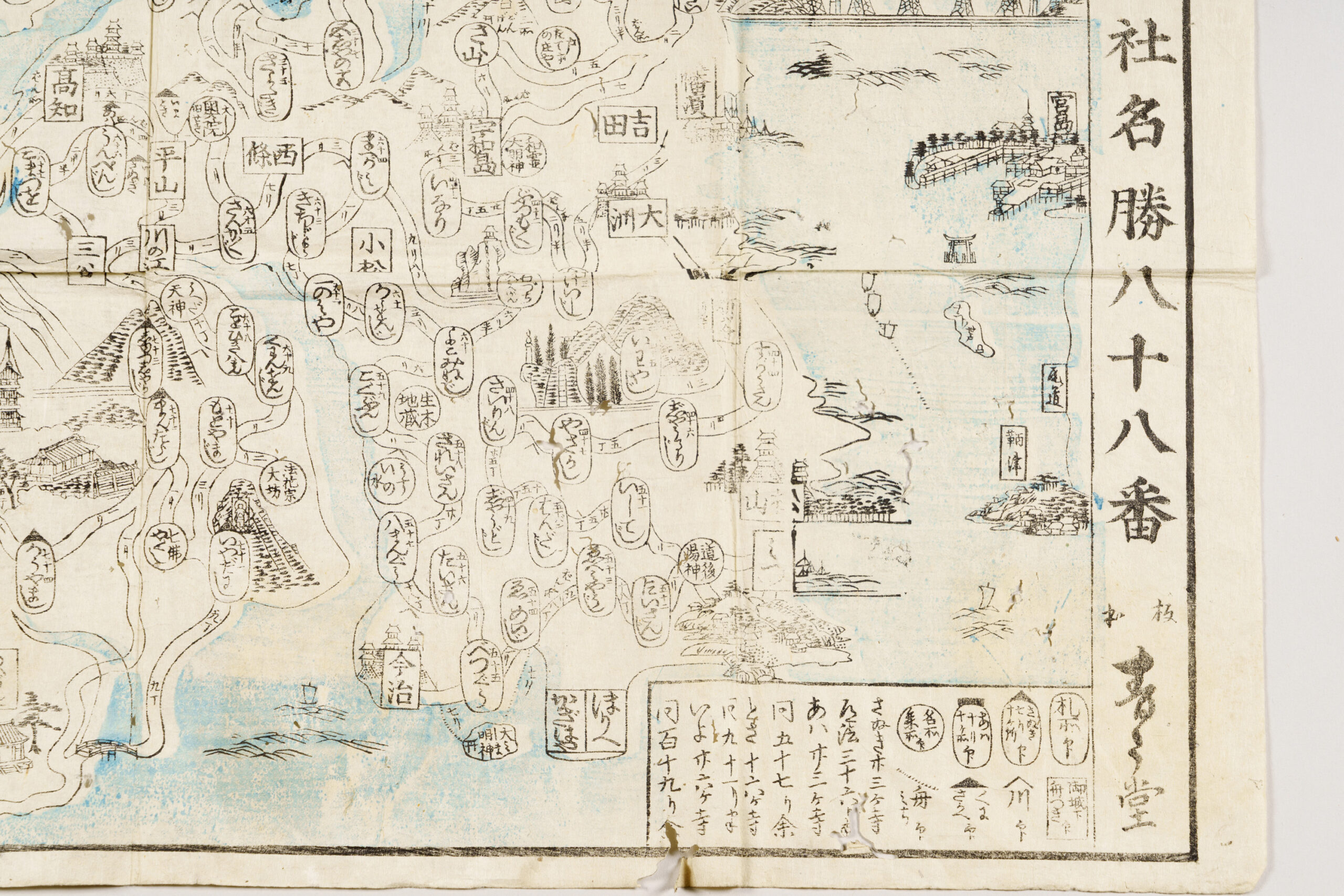
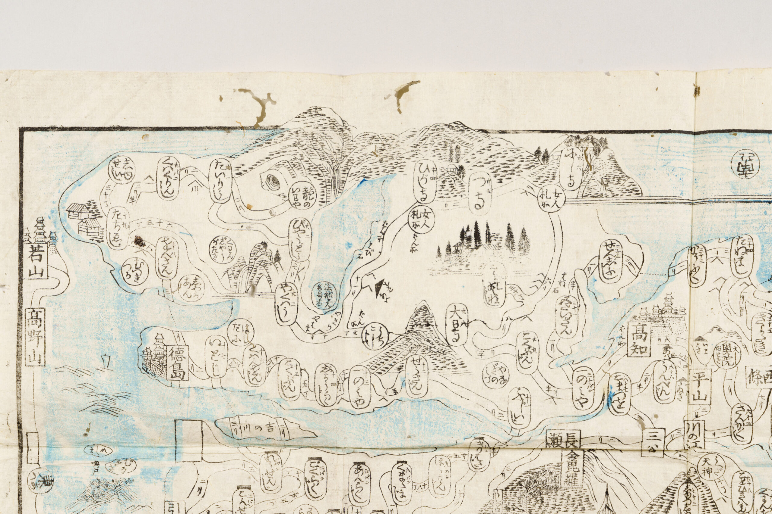
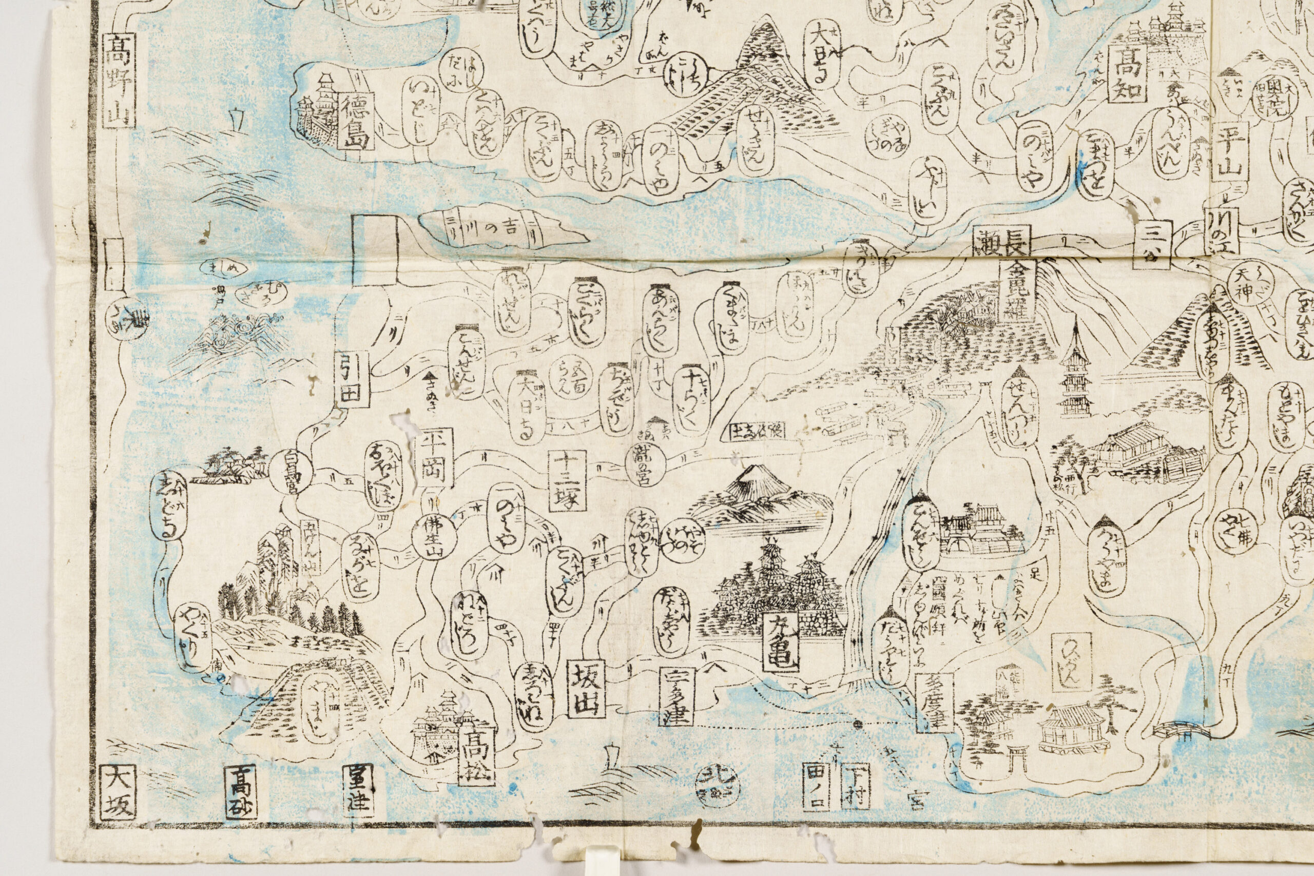
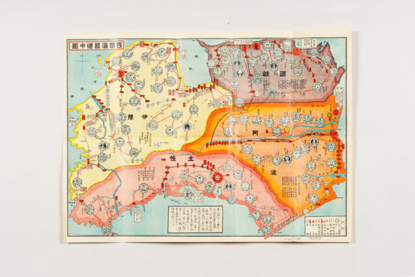
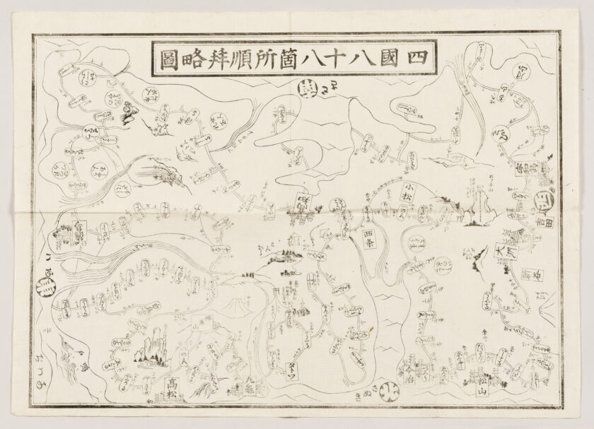
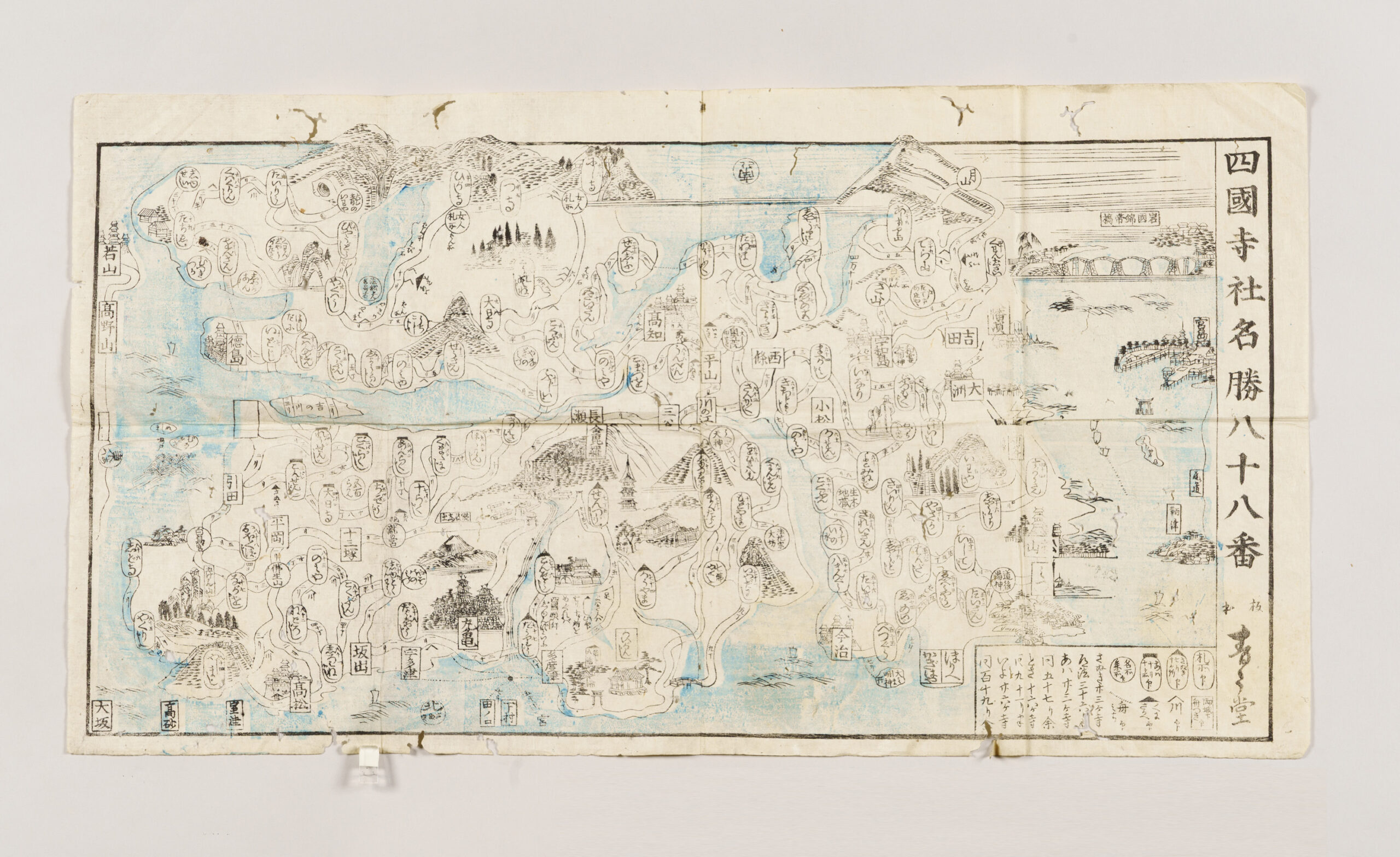
Description
This is a guide map to the Shikoku pilgrimage published by Mineemon, a publisher based in Marugame. Printed in two colors, the seas and rivers on the map are rendered in light blue. The island of Shikoku is drawn with Tosa, which is to the south, at the top. The landscape is intentionally stylized, with features such as the Yoshino River shown in exaggerated scale and the Hiuchi-nada Sea drawn like a large inlet. In addition to the land and sea routes and the distances between the sacred sites (fudasho), the map also includes illustrated depictions of prominent religious institutions other than the eighty-eight temples, such as Konpira (the present-day Kotohira-gū). It also depicts major castles, including Takamatsu Castle, as well as well-known scenic spots in Shikoku, such as the Naruto whirlpools in Awa and famous sites along the Seto Inland Sea, including the Kintai Bridge in Iwakuni (Suō) and Itsukushima Shrine in Aki, making the map highly engaging for viewers.