


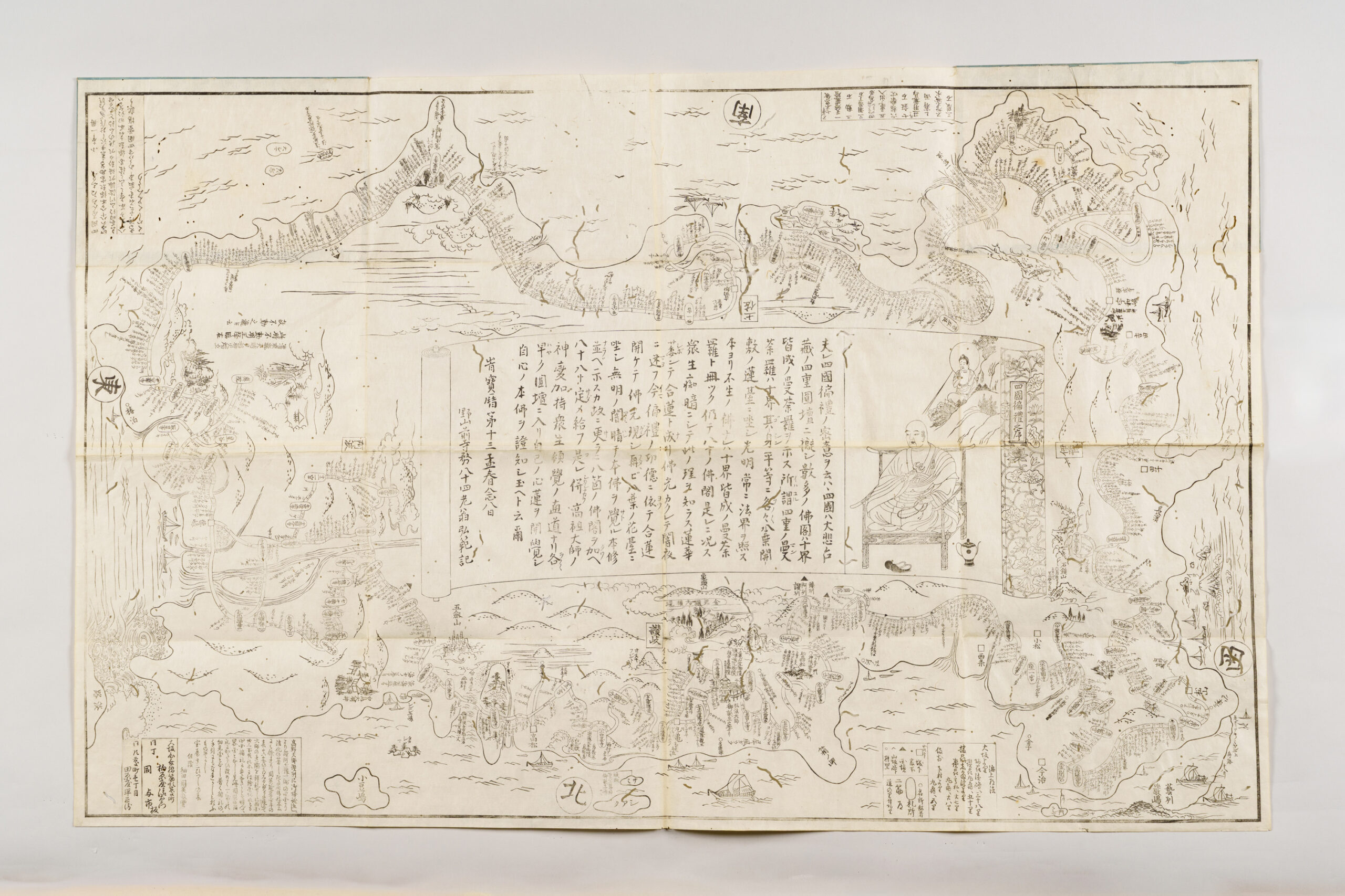
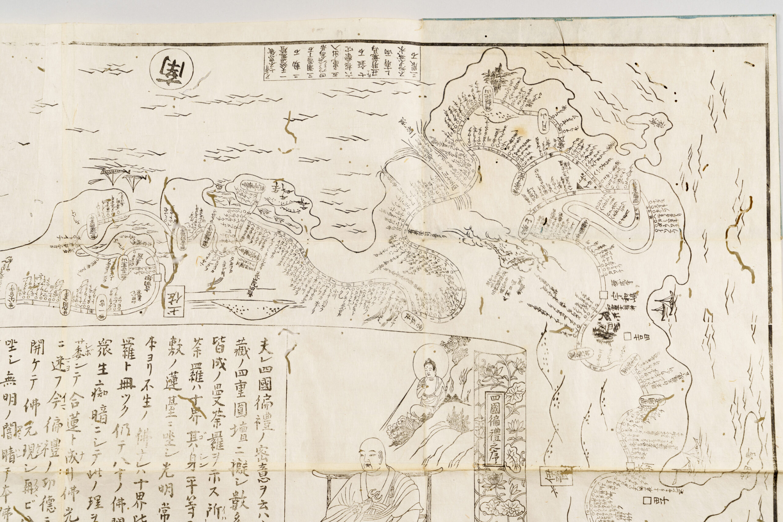
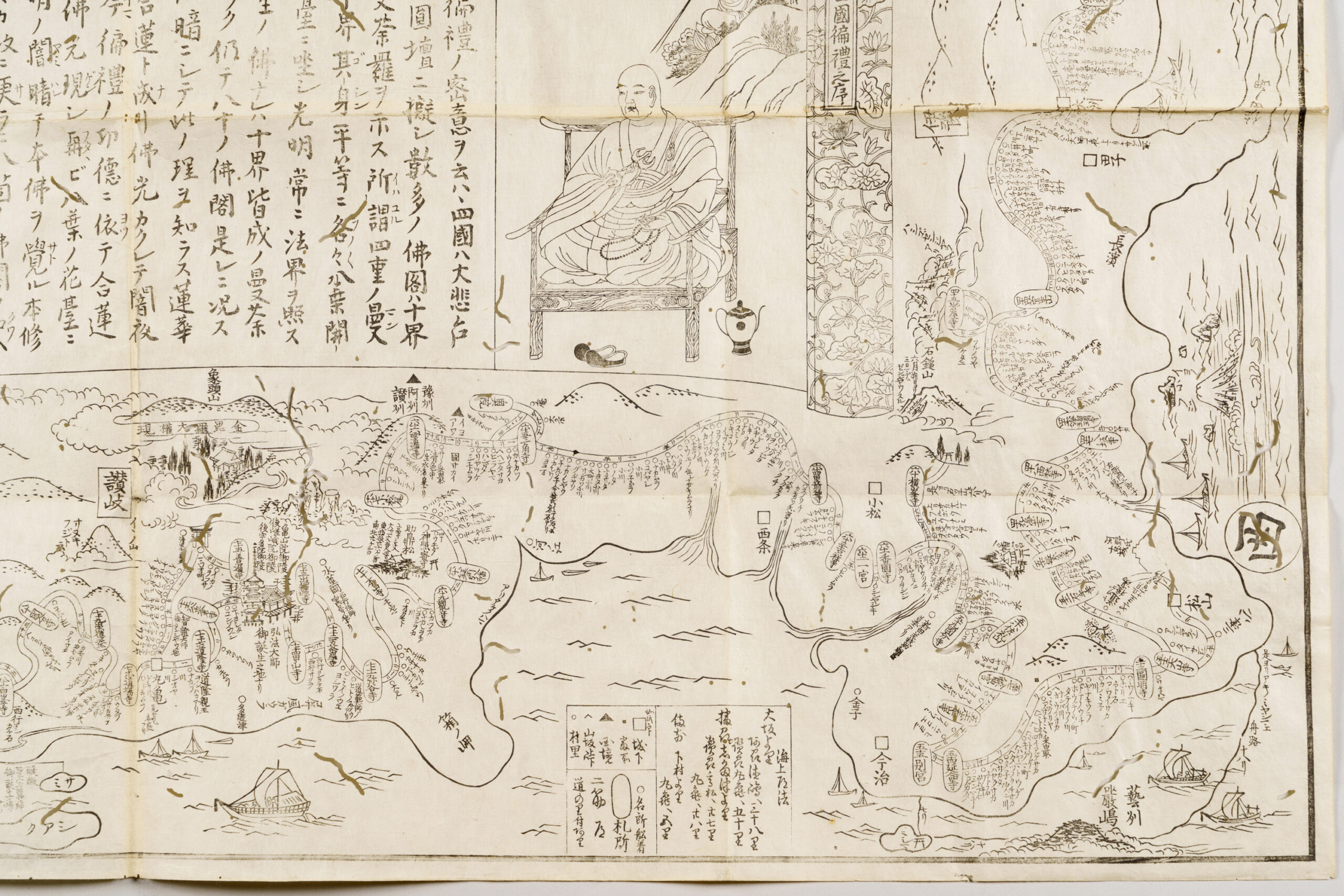
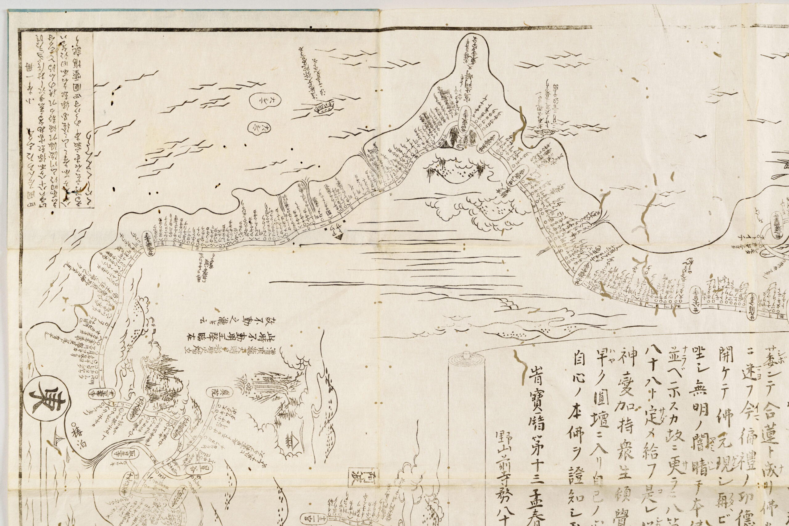
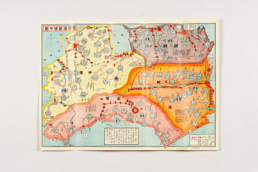
Shikoku Henro Map
- Artist
-
Hosoda Shūei (1725–1796)
- Period
-
Edo period, 1764 (Hōreki 14)
- Quality and quantity
-
Woodblock print (ink), one paper
- Size (cm)
-
H 60.2 × W 95.0
- Category
-
Other
- Accession number
-
B97000317
Description
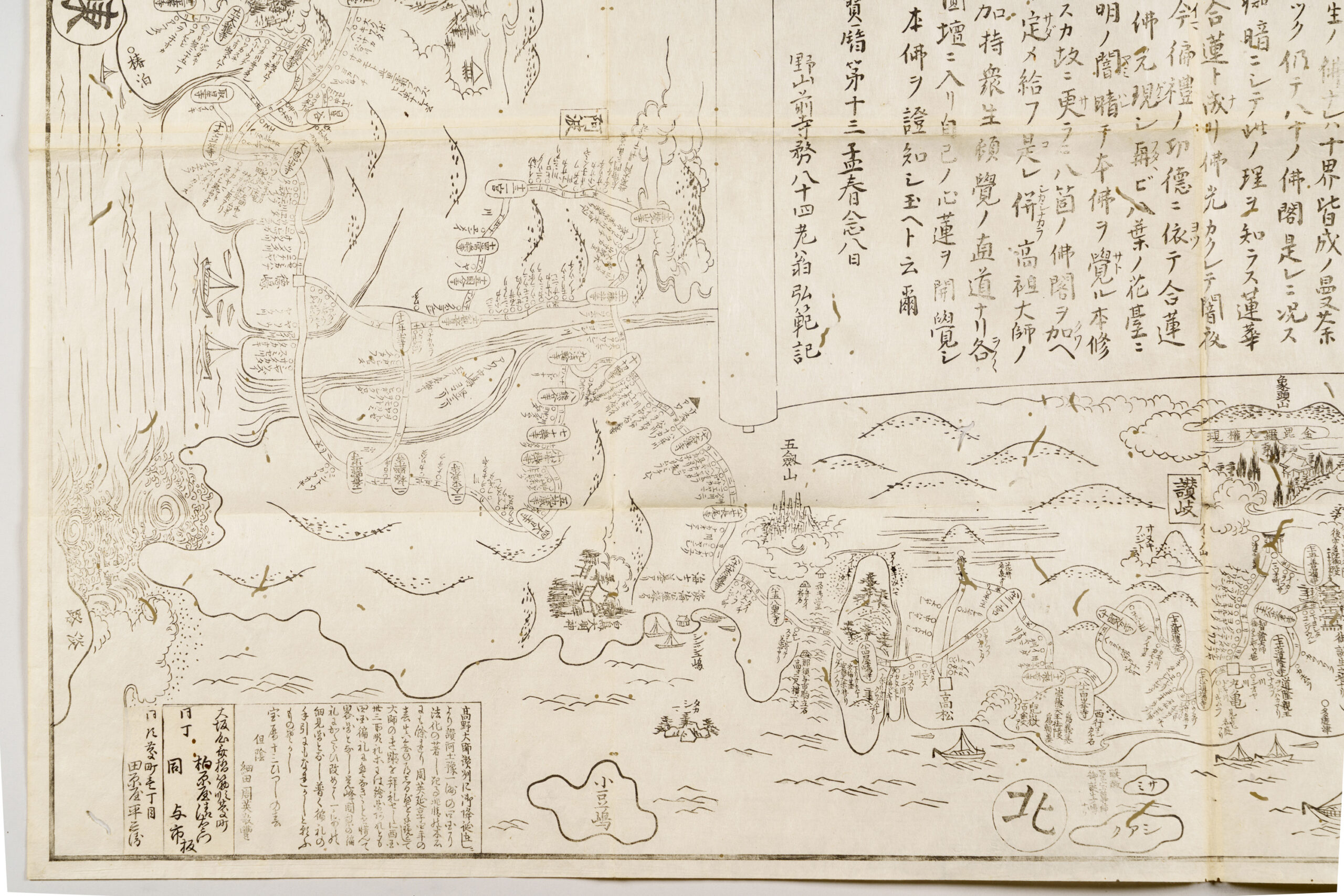
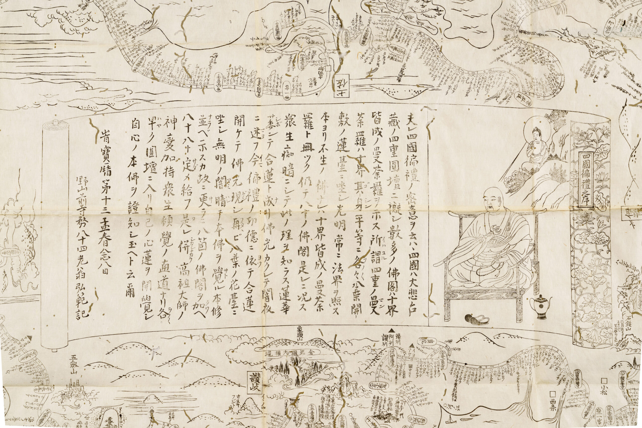
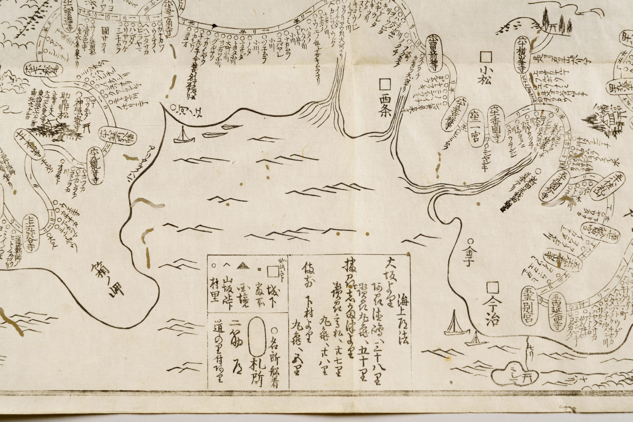
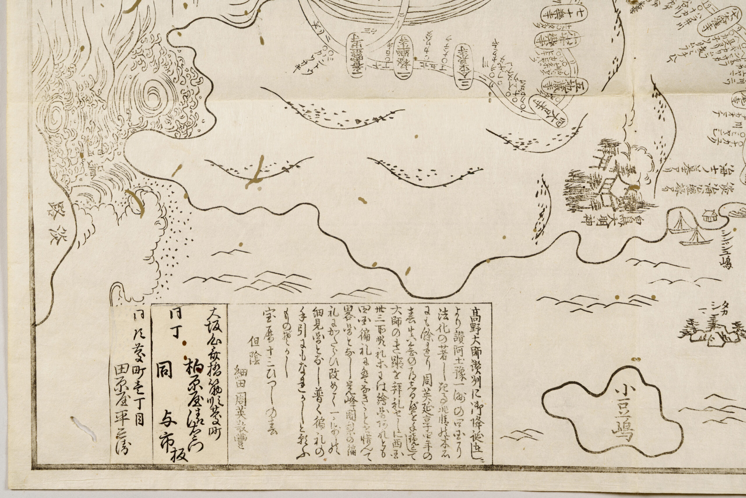
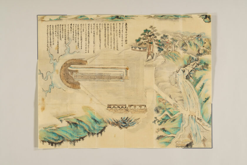
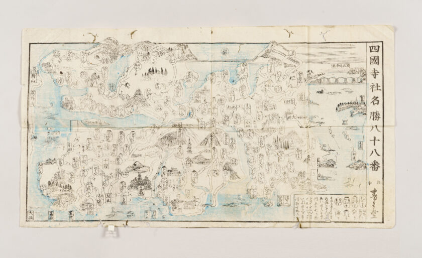
This is the oldest known map of the Shikoku pilgrimage for which the year of publication is known.
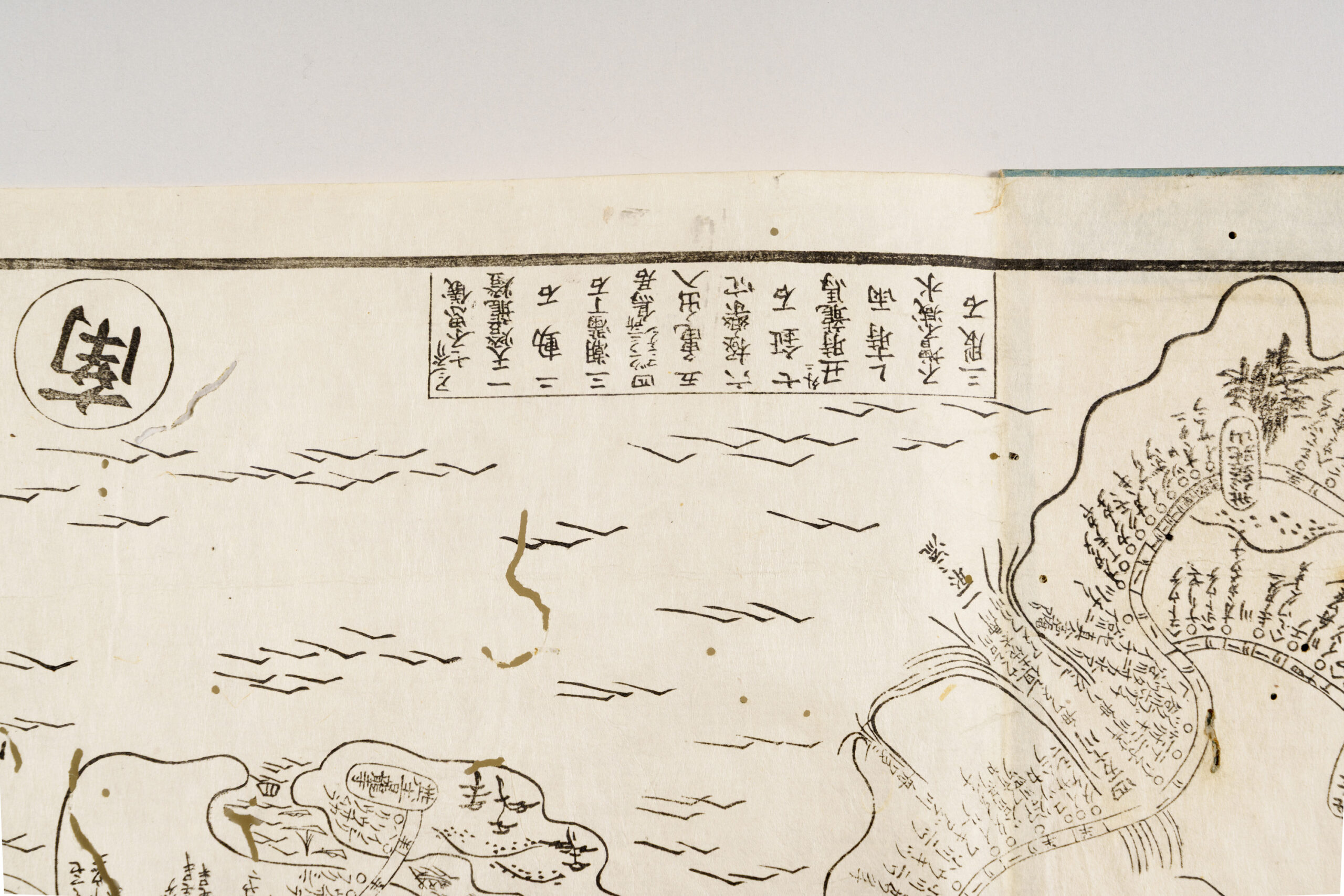
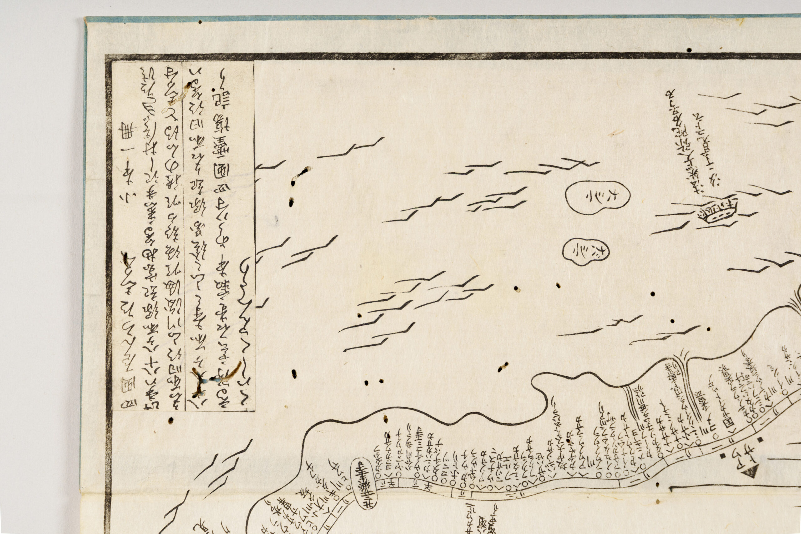
It presents the island of Shikoku with Tosa, which is to the south, at the top. The map marks all eighty-eight sacred sites (fudasho), together with the distances between them, the names of villages along the route, mountain passes, and additional points of interest beyond the pilgrimage temples. It is all recorded in fine detail. At the center is Kūkai (Kōbō Daishi), depicted in the Zentsū-ji miei style, which is based on the story of the Buddha Shakyamuni appearing to him while he was training in Sanuki. Beside the image is text by the monk Kōhan of Mt. Kōya explaining the esoteric significance of the Shikoku pilgrimage. In the lower left is an account of the map’s publication, which states that Hosoda Shūei created the work after completing the pilgrimage himself, using Shin’nen’s Shikoku Henro Michishirube as his guide. He had found it inconvenient that there were no illustrated maps of the pilgrimage, like there were for the Saigoku Kannon Pilgrimage. This work subsequently became the prototype for many later maps of the Shikoku pilgrimage.