


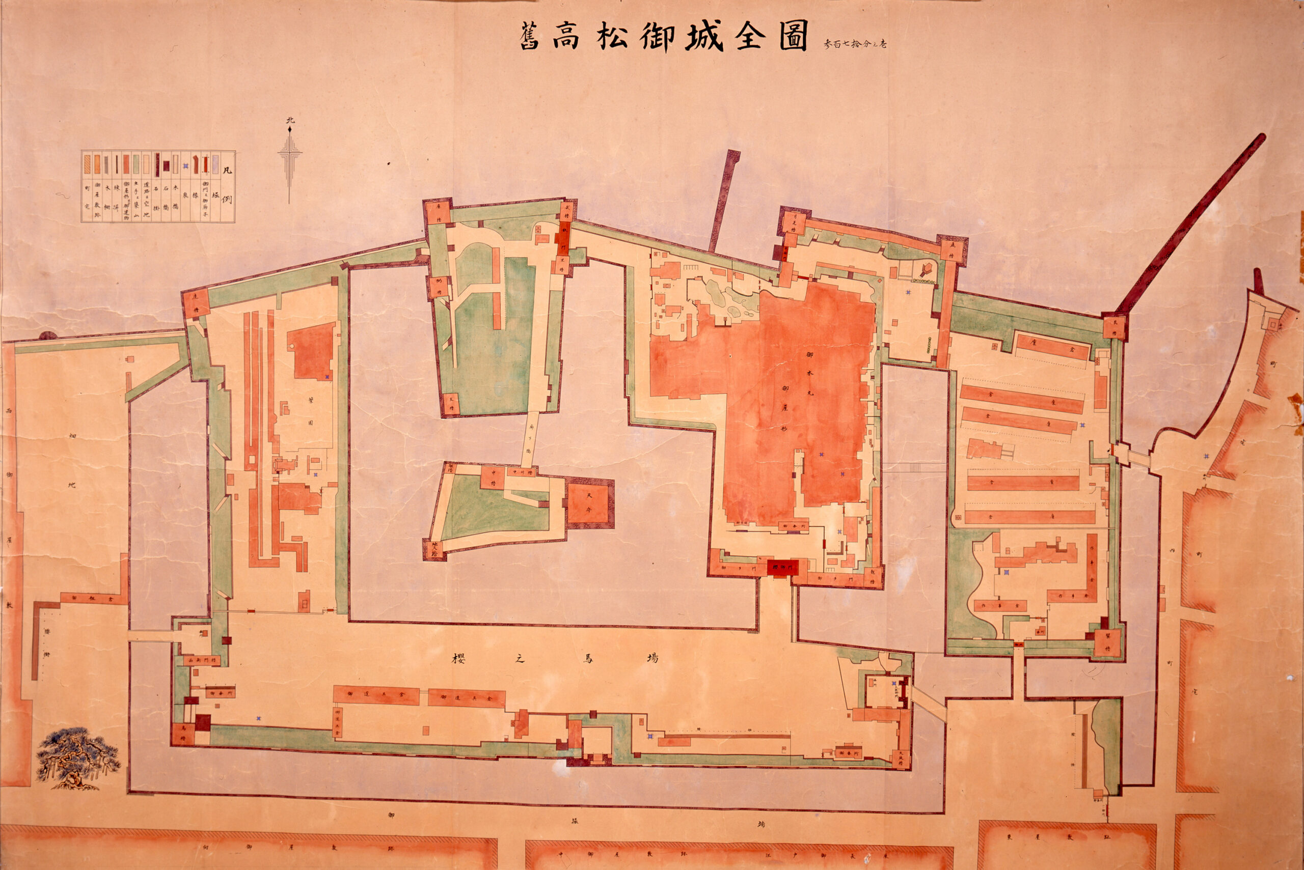
Complete Plan of the Former Takamatsu Castle
- Artist
-
-
- Period
-
Meiji period or later, 19th century
- Quality and quantity
-
Hand-drawn map with color, one paper
- Size (cm)
-
H 177.5 × W 265.0
- Category
-
Other
- Accession number
-
MY0#00021
Description
This map of Takamatsu Castle is thought to have been drawn in the modern period or later. It depicts the area inside the middle moat, the core zone of the castle, which was originally constructed by Ikoma Chikamasa and later inherited by the Takamatsu Matsudaira family as their residence.
The stated scale of 1:370 suggests that the map was created based on actual measurements. It is an important source of information about the castle’s interior, including the shapes, locations, and names of structures such as the turrets, gates and residential buildings. Turrets are an important component for protecting the castle from attacks. A total of eighteen turrets can be identified. Six of the turrets, one-third of them, are positioned along the northern side. As Takamatsu Castle directly faced the sea, this arrangement reflects a defensive strategy that was oriented toward attacks from the seaward side. The brown-colored areas represent buildings. The largest structure, labeled “御本丸御屋形 (Gohonmaru Oyakata),” was the lord’s residence and administrative hall, known as the Hiunkaku.